North Carolina Space Grant and Sea Grant Programs Announce 2024-25 Joint Research Fellows

The North Carolina Sea Grant and Space Grant programs are pleased to introduce the recipients of the 2024-25 joint research fellowships, Megan Geesin and Peggy Mullin. This fellowship supports interdisciplinary research addressing critical challenges in the state’s coastal and watershed environments.
Fellowship recipients utilize relevant measurement instruments and/or remote-sensing data resources from the National Aeronautics and Space Administration (NASA), the National Oceanic and Atmospheric Administration (NOAA), or other federal, state, or commercially available datasets.
Megan Geesin, “Assessing the Ability of Oyster Breakwaters to Reduce Shoreline Erosion and Stimulate Marsh Growth”
Megan Geesin, a Ph.D. candidate from East Carolina University, will be conducting research on the effectiveness of oyster breakwaters in mitigating shoreline erosion and stimulating marsh growth in North Carolina’s Albemarle-Pamlico estuarine system.
Coastal erosion accelerated by human activity necessitates innovative shoreline protection methods. Geesin’s project will assess oyster breakwaters, which combine natural habitat restoration with engineered structures to stabilize shorelines.
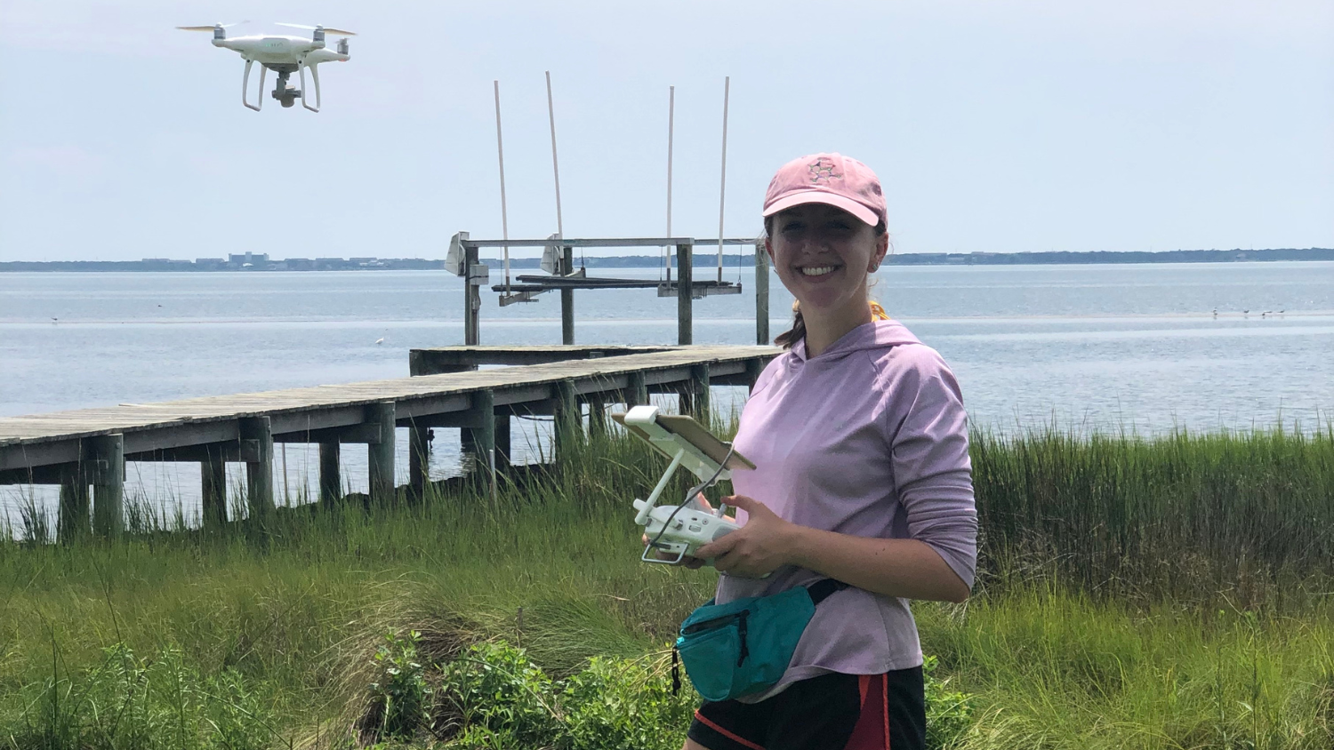
Using unmanned aerial systems (UAS), Geesin will collect high-resolution imagery of oyster breakwaters and surrounding marsh areas. This data is processed using advanced techniques like structure-from-motion (SfM) to create 3D models and monitor changes in shoreline elevation over time.
Geesin’s investigation into oyster breakwaters promises to advance sustainable shoreline protection strategies amidst accelerating coastal erosion. By evaluating the effectiveness of these natural-engineered structures using state-of-the-art UAS-SfM technology, her research will provide crucial insights into their long-term viability and ecological benefits.
“As living shorelines and oyster breakwaters become a more popular shoreline stabilization method, it is important to understand the benefits and trade-offs of different substrates under different environmental conditions,” says Geesin. “These findings can help managers choose the best shoreline protection option for areas prone to accelerated erosion and habitat loss.”
Geesin’s findings are expected to inform policy makers, coastal planners, and environmental managers on optimal approaches to shoreline stabilization that enhance resilience to climate change impacts. Moreover, her methodology of integrating remote sensing with ecological monitoring sets a precedent for scalable and cost-effective coastal management practices.

Peggy Mullin, “Advancing the Use of Remote Sensing to Measure Water Quality and Detect SAV and Marsh Habitat in Currituck Sound”
Peggy Mullin, a master’s student at the University of North Carolina at Chapel Hill, will conduct research that focuses on understanding dynamics in salt marshes and submerged aquatic vegetation (SAV) communities in Currituck Sound.
Mullin aims to quantify relationships between water quality parameters, such as Colored Dissolved Organic Matter (CDOM), and the presence and extent of SAV in Currituck Sound. Her research will utilize remote sensing tools to develop new methods for monitoring and conserving these vital habitats.
“By exploring the use of remote sensing tools to measure CDOM in Currituck Sound, this work represents an opportunity to expand and refine ongoing water quality modeling efforts in coastal North Carolina, helping managers and residents better monitor water quality in the region,” says Mullin.
This project seeks to refine bio-optical models using satellite and drone data to enhance water quality monitoring and habitat conservation efforts. By mapping SAV and salt marsh extent and assessing their spatial relationships, Mullin’s work will contribute to understanding habitat transformations in response to environmental changes.
“Every year, remote sensing becomes more powerful and more accessible. If the results of this research show that remote sensing can complement existing efforts in monitoring marshes, SAV, and CDOM, these approaches can save researchers valuable time and effort while helping to capture long-term trends in dynamic regions,” says Mullin.
Mullin’s research will advance understanding of these critical habitats’ response to changing environmental conditions. By refining bio-optical models through satellite and drone imagery, Mullin aims to improve monitoring and conservation efforts for these invaluable ecosystems. Her work not only contributes to habitat preservation in North Carolina but also establishes methodologies transferable to other estuarine systems facing similar challenges worldwide.
Partnership with Louisiana
In a unique collaboration, the North Carolina Space Grant and Sea Grant Programs are partnering with Louisiana to fund graduate research fellows in both states. This partnership aims to address common challenges related to sediment loss, erosion, and coastal habitat degradation.
While each state’s fellows will pursue independent research projects, they will engage collaboratively to share insights and foster regional knowledge exchange. This initiative not only enhances the research capabilities of both programs but also promotes interdisciplinary approaches to tackling coastal resilience issues across different geographic and ecological contexts.
“Working regionally allows a larger area of habitat types, environmental conditions, and existing management strategies to be studied,” says John Fear, deputy director of North Carolina Sea Grant. “This ‘bigger picture’ perspective will hopefully make the results of each project more relevant across many areas, not just where the work took place.”
- Categories:


